This trip was the subject of a talk (August 2001) to the Lower Hudson Valley group of the Sierra Club. More photographs of my trip can be seen on these pages: Man and Rock in the Shimshal Valley. I've reorganized this so that the images are only shown as thumbnails here, but clicking on the image takes you to a larger version. Click here to go to a tour of the larger versions only.
|
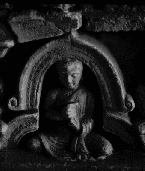
| This photo shows a small stone-carved buddha on a stupa in one of the temple complexes at Gandara. Gandara is near the site of present day Taxila. The hand posture is the vajramudra - the mudra of the knowledge fist. |
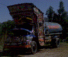
| This truck was parked in Taxila. It's typical of the highly decorated lorries that drive around Pakistan. Gaudy, glistening vehicles painted with apotropaic phrases in English and Urdu. |
|
|
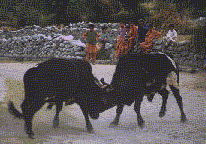
Gilgit is an old colonial town, the last foothold of the British in the North West Frontier Province. Nearby, one can walk to the Buddha of Karga Nala, carged into the rock high overhead in a cliff. On the walk back from the village to Gilgit, the way was blocked by these duelling bulls. Horns locked, they pushed back and forth across the dusty road, watched by entertained and unconcerned locals. |
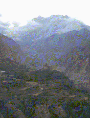
| Altit lies further up the valley and is the site of this fort, the residence of the local Bey. This is the view North along the valley from neighbouring Karimabad, a small village perched above the KKH. |
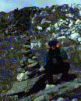
| This slide shows a picture of me sitting on the Passu glacier, above the Karakoram highway. I'm sitting next to a cairn I've just built from morraine. |
|
|
|
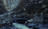
This photograph shows a suspension bridge that one has to cross going from Dut, North-East towards the village of Shimshal. I'm looking down on the bridge, before descending the cliffs to reach it. The bridge is precariously constructed from planks, rocks and rusted steel rope. The whole thing rests on a pick-axe head jammed into the rock. |
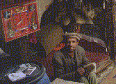
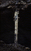
| Marked on the map as `Dut', there is nothing here but an empty house and a shop. Bizarrely, Habib keeps shop a day's walk from the nearest other person, yet he has a tremendous stock of shoes and sugar, and the ubiquitous Pakistani biscuits. |
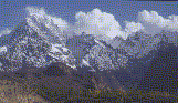 |
Finally, after two days in the claustrophobic valley, I walk out to its mouth, where it joins the main valley. On the far bank, the snow-capped mountains tower above.
|
| The Karakoram highway gently descends through desolate grassland into China from the Khunjerab pass, passing Kazakh yurts beneath Muztagh Ata (Ice mountain father). At the first checkpoint in China, the traveller is met by a swarm of children selling pepper bread - a delightful contrast after weeks of Mutton curry. |
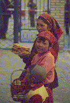
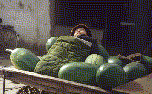 | In the centre of Kashgar, a major crossroads on the Silk route, People from all over the region converge to trade. Here, on a melon-seller's cart, his baby rests in the sun, camouflaged in a green sleeping bag. |
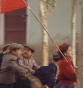 | This parade of children, led by a girl with a red flag marched tumultuously through the centre of Kashgar. |
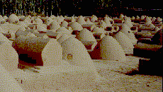
| At the Abakh Hodja tomb on the outskirts of Kashgar is this Muslim necropolis of mud domes. |
For more information about the photographs, feel free to contact me by email.